
MTBE Contamination
MTBE (methyl tertiary butyl ether) contamination in an area on Long Island migrated from a site that reported a release involving several feet of gasoline in the ground. MTBE is a toxic gasoline additive that can cause extensive groundwater and soil gas vapor hazards. The pollution extended under two nearby school properties and into an adjoining residential community. Toxics Targeting compiled and attributed groundwater monitoring results using digital ortho photos.

MTBE Groundwater Contamination
MTBE (methyl tertiary butyl ether) groundwater contamination was reported at two gas stations along a major thoroughfare on Long Island. The pollution plume migrated through a large residential area, impacted a private water supply well and was reported under a public school property. Toxics Targeting compiled extensive groundwater monitoring results and attributed MTBE levels using digital ortho photos.

Petroleum Plume
Approximately 30 million gallons of petroleum reportedly accumulated in this area of the Greenpoint section of Brooklyn, NY, where oil facilities have operated for more than a century. The free-floating product plume was delineated using more than 100 monitoring points. Toxics Targeting compiled product depth data, soil gas monitoring results, property boundaries, building footprints, real property information, historic aerial photos and other historic maps.

Petroleum Plume and Soil Gas Vapor Concentrations
This illustrates the free-floating petroleum plume as well as soil gas vapor concentrations of benzene at less than 10 feet below grade surface. Benzene is a known human cancer-causing agent.

Petroleum Plume and Historic Aerial Photo
This illustrates the free-floating petroleum plume with regard to a historic aerial photo from circa 1962. An area of petroleum up to 8.91 feet in depth is clearly located over a former tank farm.

Leaking Gasoline Tanks & Spills in Queens, NY
Approximately 500,000 residents of southeastern Queens have traditionally been supplied with drinking water drawn from the ground. Toxics Targeting mapped the locations of the former Jamaica Water Supply System's wells and compiled leaking tank and spill data for the entire service area.
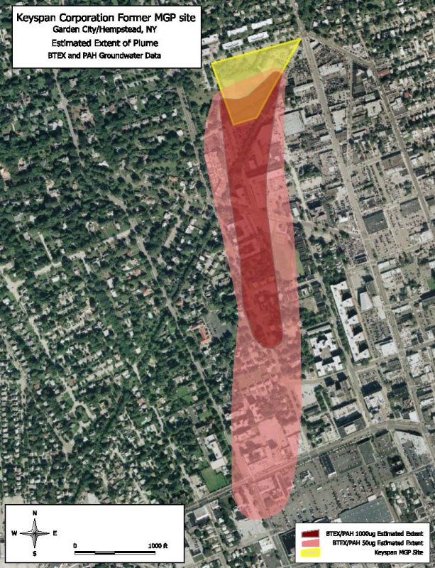
Manufactured Gas Plant Plume
A former Manufactured Gas Plant reportedly generated up to four feet of non-aqueous-phase-liquid (NAPL) coal tar that migrated approximately 400 feet downgradient of the site. Groundwater pollution was detected up to 3,800 feet downgradient of the site. Toxics Targeting compiled groundwater monitoring results, tax parcel boundaries and real property data. The groundwater plume is delineated on a digital ortho photo.

Manufactured Gas Plant Plume on Tax Parcel Coverage
This illustrates the Manufactured Gas Plant's reported plume on a tax parcel coverage.

Long Island Project
Toxics Targeting searched 21 categories of environmental data for an entire town on Long Island. All identified known and potential toxic sites were mapped and profiled. Toxics Targeting's report was divided into multiple sections to allow the information to be visually analyzed more easily.
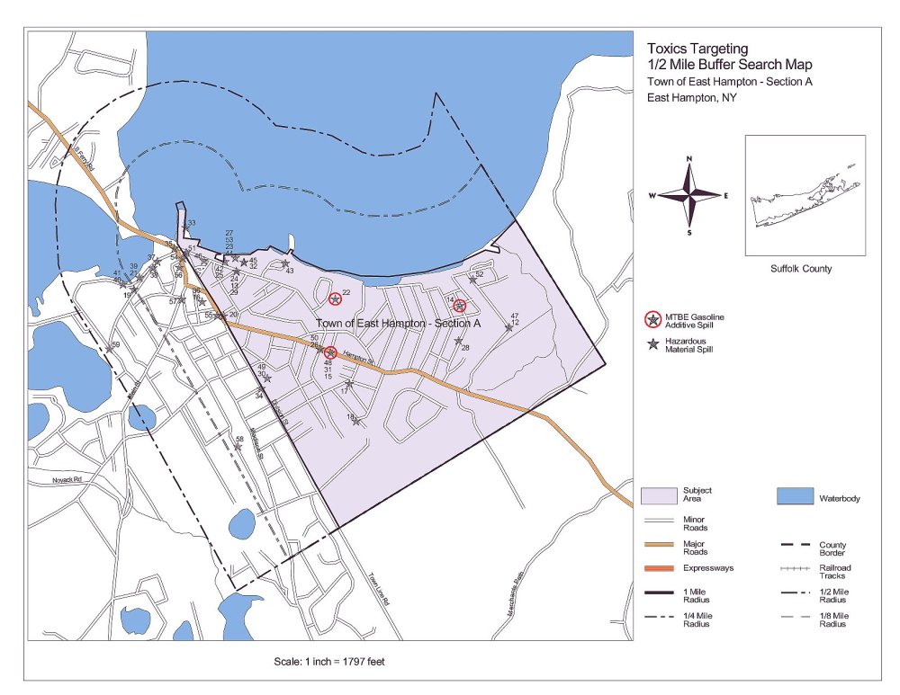
Segment Map
This is a map for an individual segment of the town-wide report.
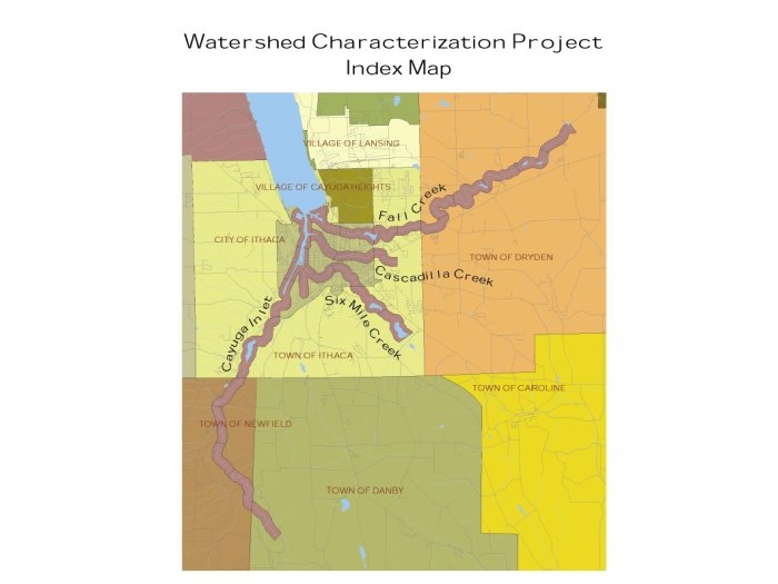
Preliminary Watershed Characterization
Toxics Targeting compiled data for a Preliminary Watershed Characterization of the southern end of Cayuga Lake, which is listed on the national 303(d) registry of impaired waterbodies due to excessive levels of turbidity, nutrients and pathogens. More than 1,000 sources of pollution were identified by a field investigation that surveyed nearly 100 miles of tributary streambanks combined with a compilation of Toxics Targeting's environmental databases. This project was undertaken to support development of a Total Maximum Daily Load (TMDL) to alleviate and eliminate the sources of the lake's impairments.
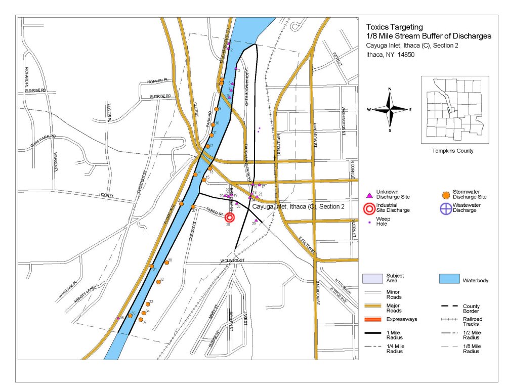
1/8-Mile Stream Buffer of Discharges
Toxics Targeting's Preliminary Watershed Characterization comprised 28 individual stream segment reports. Even though a Total Maximum Daily Load (TMDL) for the southern Cayuga Lake was designated a "high priority" in 2002, it still has not been proposed. Nevertheless, Toxics Targeting's data has helped generate more than $75.0 million in remediation efforts by responsible parties or government authorities. This project is arguably the most-successful grassroots community clean up program in the nation.
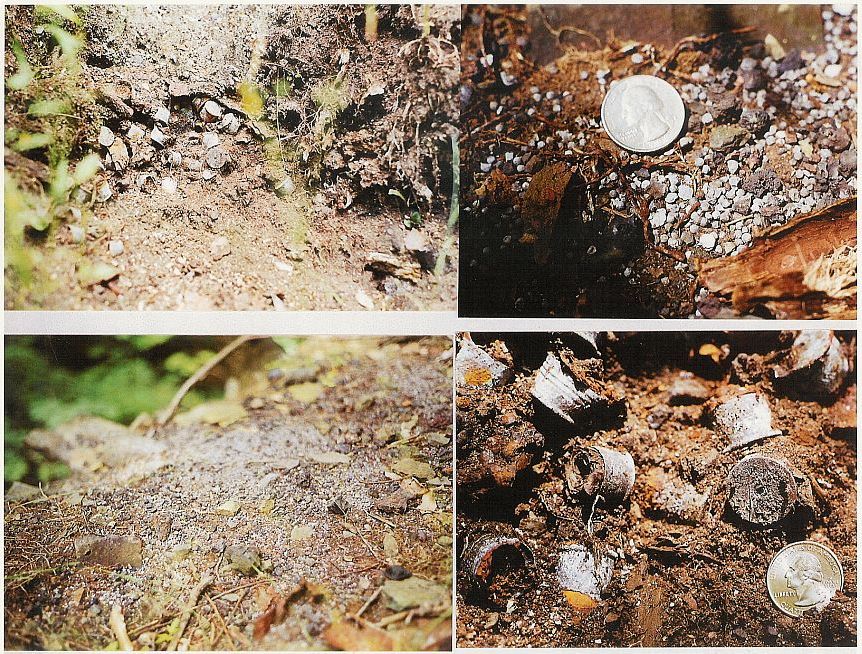
Lead Shotgun Pellets and Brass Shotgun Shell Casings
In July 2000, Toxics Targeting identified extensive lead shotgun pellets and brass shotgun shell casings at the historic Ithaca Falls site in Ithaca, NY. The waterfall is associated with a major tributary to Southern Cayuga Lake. Lead contamination in soil at the site was monitored up to 215,000 parts per million.
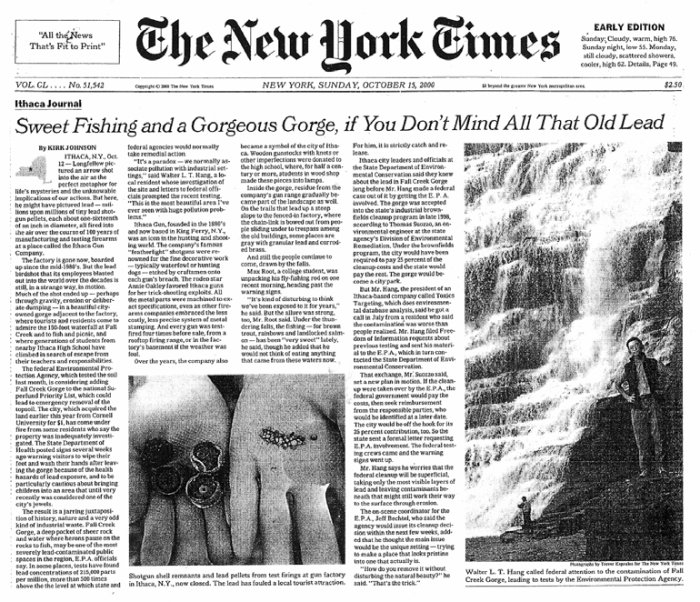
New York Times Coverage
Toxics Targeting's public disclosure of high-level lead contamination at Ithaca Falls led to widespread national media coverage.
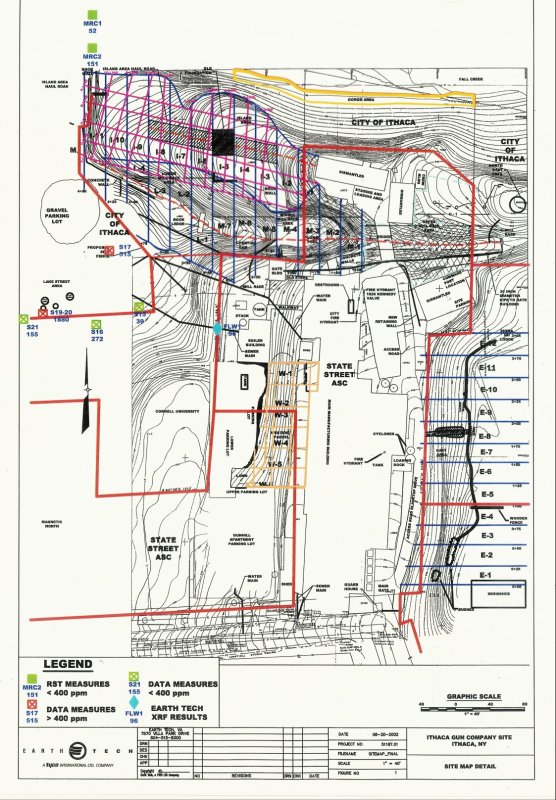
Site Map Detail
Ithaca Falls is listed as a Federal Superfund site and was the subject of a $4.8 million "emergency removal action" that transported approximately 6,000 tons of lead-contaminated soils from the site. The highly sophisticated remediation project involved vacuum trucks equipped with internal baghouse filters as well as an external HEPA filter. Additional contamination hazards at the former Ithaca Gun factory are currently the subject of a proposed brownfields redevelopment.
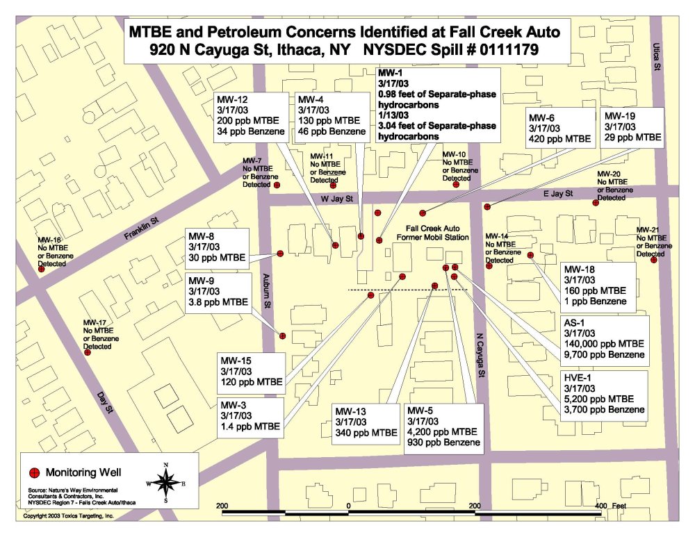
Groundwater Monitoring Results
Toxics Targeting compiled groundwater monitoring results for a former gas station site in Ithaca, NY. The site has extensive MTBE (methyl tertiary butyl ether) contamination.
Source Removal
The site was the subject of an extensive "source removal" that excavated more than 3,000 cubic yards of contaminated materials and hundreds of thousands of gallons of impacted groundwater. Rigorous efforts were made to mitigate volatile emissions in order to safeguard public health.
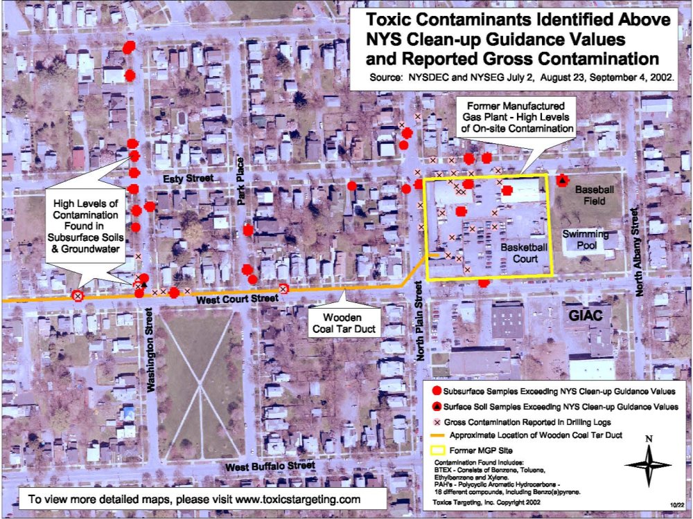
Manufactured Gas Plant (MGP) in Ithaca, NY
Toxics Targeting compiled data for a Manufactured Gas Plant (MGP) in Ithaca, NY with extensive coal tar contamination that migrated over two city blocks. Polynuclear aromatic hydrocarbons exceeding applicable clean up requirements were identified over widespread areas.
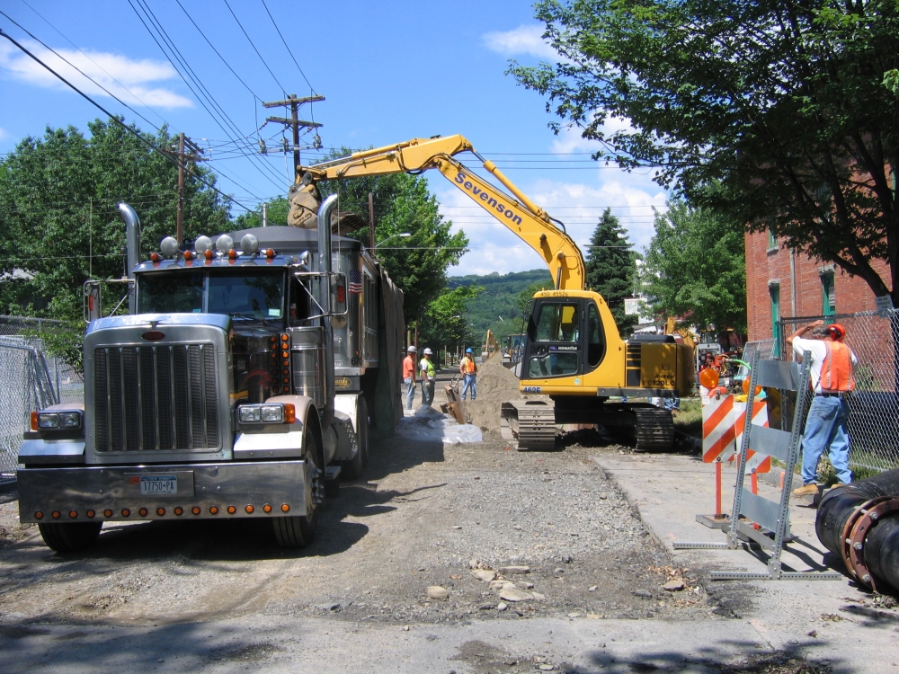
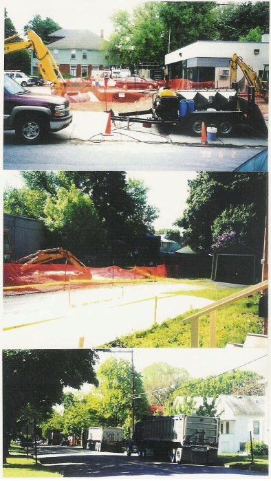
Large-Scale Excavation
Over a two-year period, large-scale excavation of contaminated soil and groundwater was conducted along the alignment of a "wooden duct" that conveyed coal tar from the MGP to a nearby waterway. The second phase of the project will involve remediating extensive contamination on the MGP site.
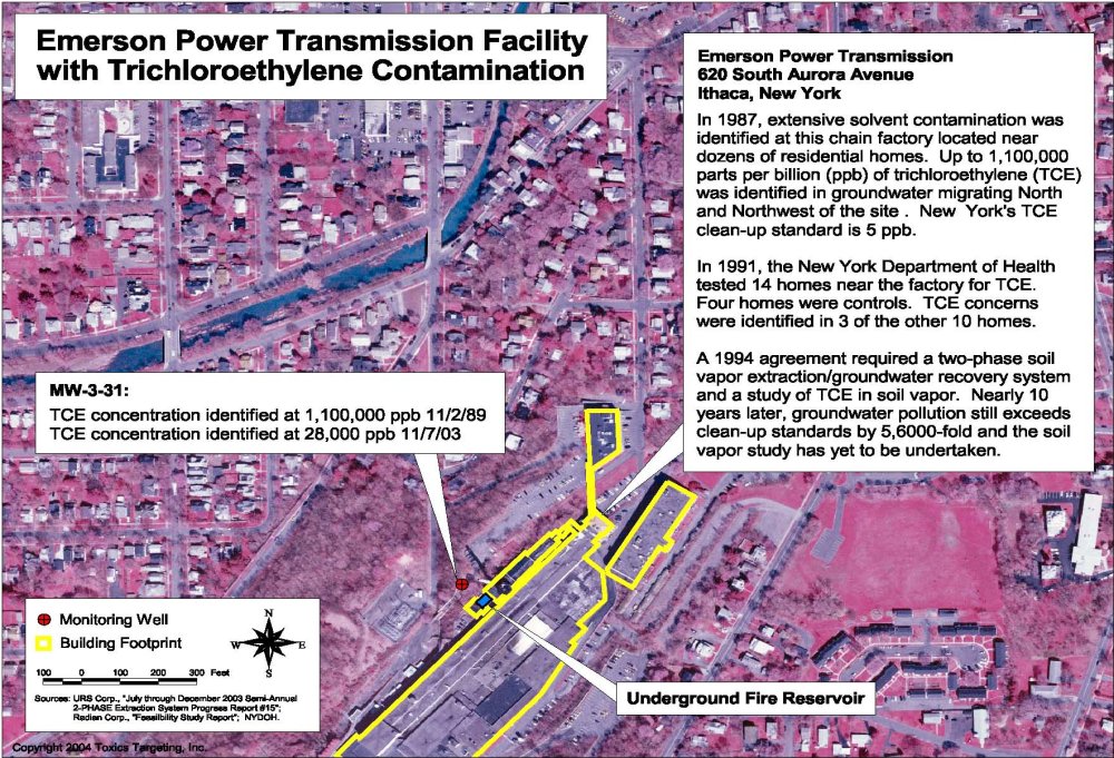
Trichloroethylene Pollution
Beginning in 2004, Toxics Targeting compiled soil, groundwater and air contamination results at a chain factory in Ithaca, NY. The facility and its surrounding neighborhood are impacted by trichloroethylene, a wide range of other chlorinated solvents and other toxic chemicals. The pollutants threaten hundreds of residential homes, schools, structures and Six Mile Creek. The chain factory involves one of the largest soil gas vapor intrusion investigations in New York State.
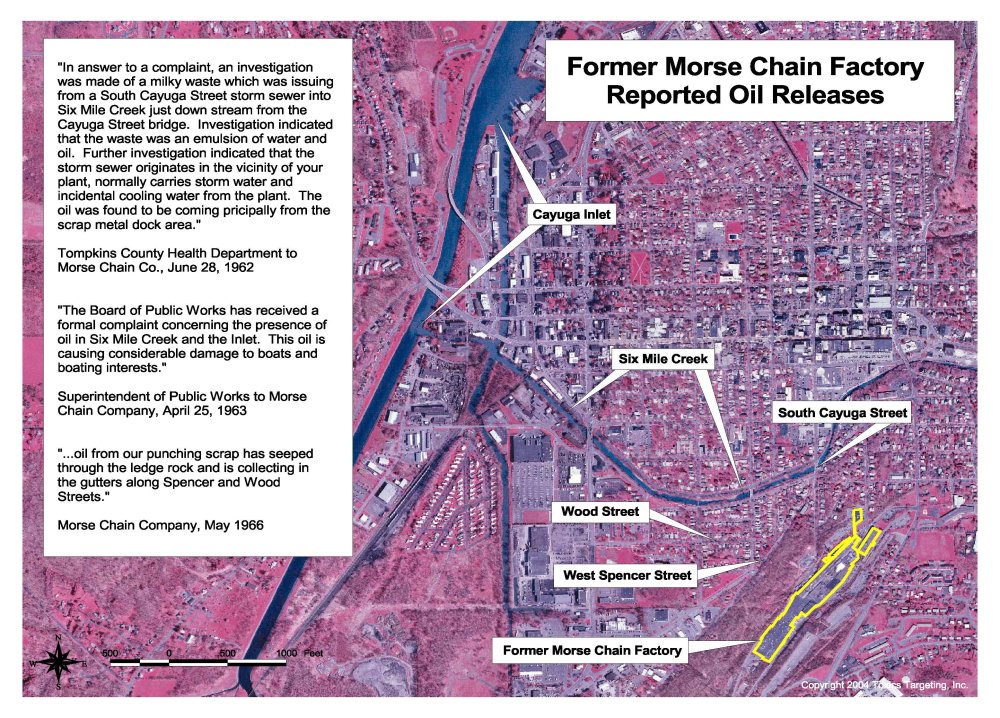
Oil Contamination
Oil contamination associated with the chain factory reportedly migrated more than 600 feet downgradient of the factory site and collected in the gutters of residential streets. Oil also migrated nearly a mile through a stormwater conduit and along a major tributary to Southern Cayuga Lake.
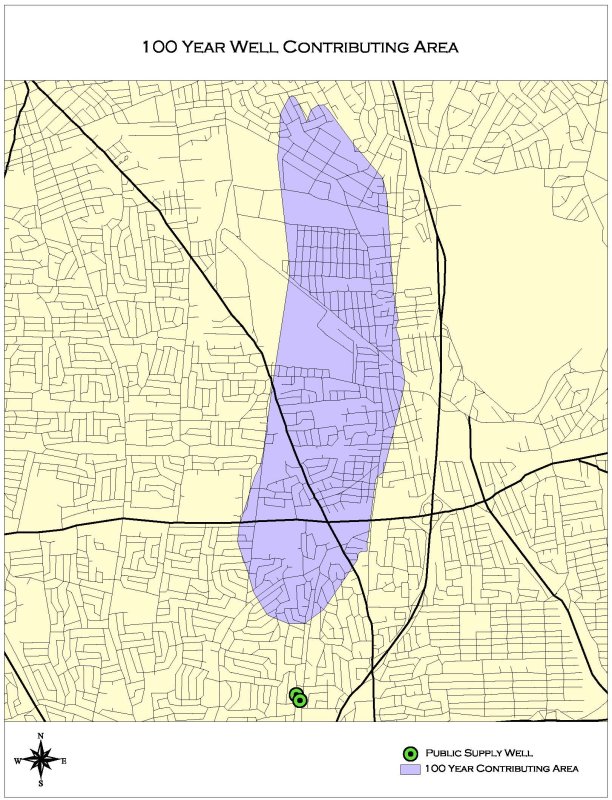
Delineation of Recharge Zones
Toxics Targeting has delineated 25-year, 50-year or 100-year time-of-travel recharge zones for dozens of public water supply wells. We compile toxic site information within those SWAP (Source Water Assessment Program) zones for further analysis. Sites can be separated into various risk categories for further investigation and action.
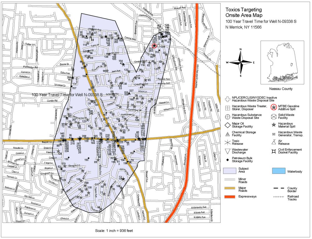
SWAP Zone Map
This SWAP zone map identifies nearly 100 known and potential toxic sites within the recharge area of two public water supply wells on Long Island. The identified sites include MTBE (methyl tertiary butyl ether) releases, an Inactive Hazardous Waste Disposal Site, hazardous waste generators and dozens of leaking tanks and spills. Each mapped site can be given a unique identifier number to allow it to be tracked on a going-forward basis.
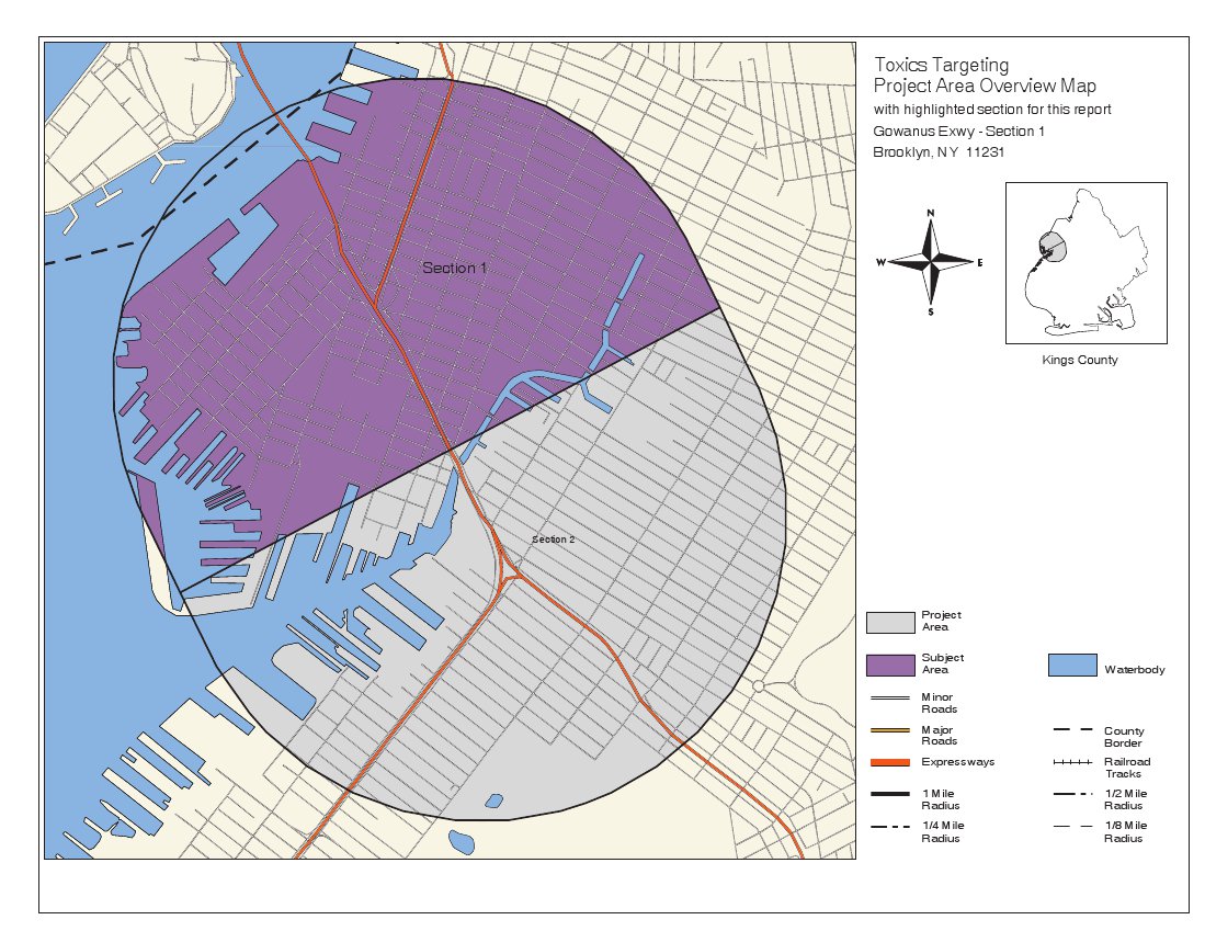
Section 1 Overview
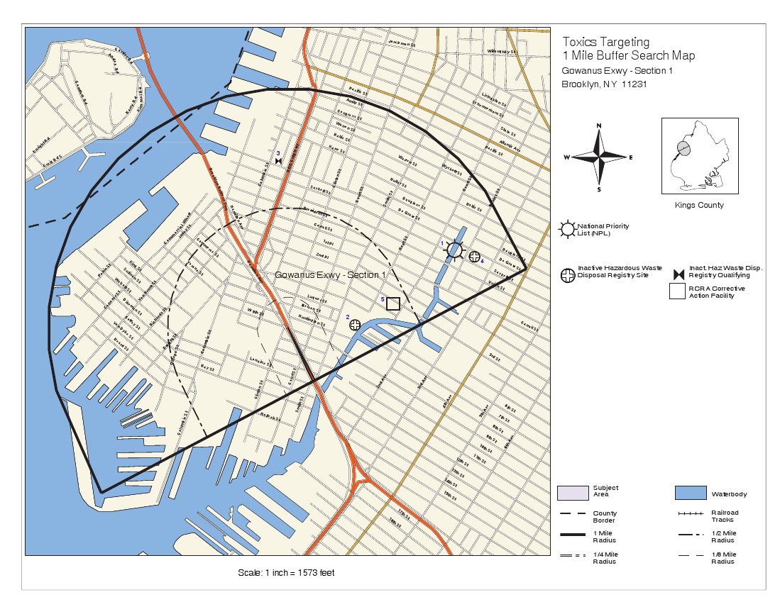
Section 1 1-mile Buffer
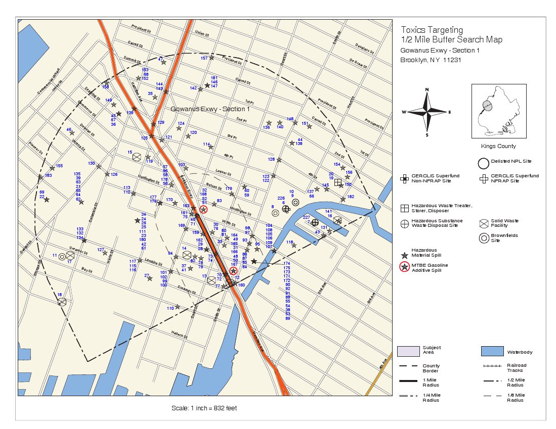
Section 1 1/2-mile Buffer
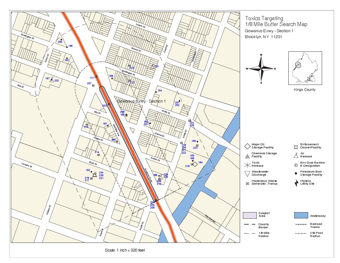
Section 1 1/8-mile Buffer
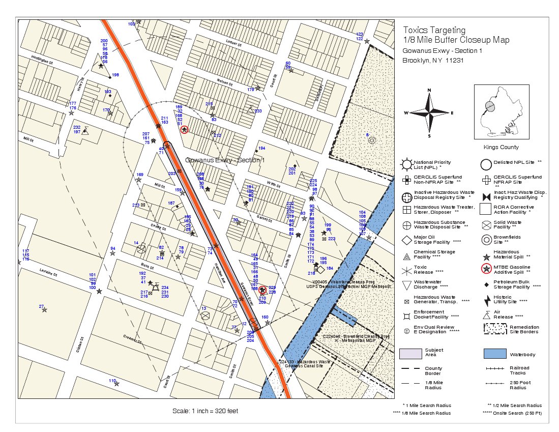
Section 1 1/8-mile Buffer Close-Up
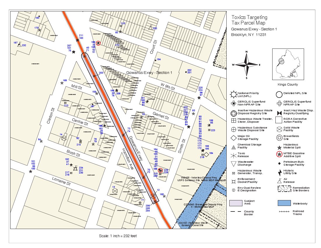
Section 1 Tax Parcel Map
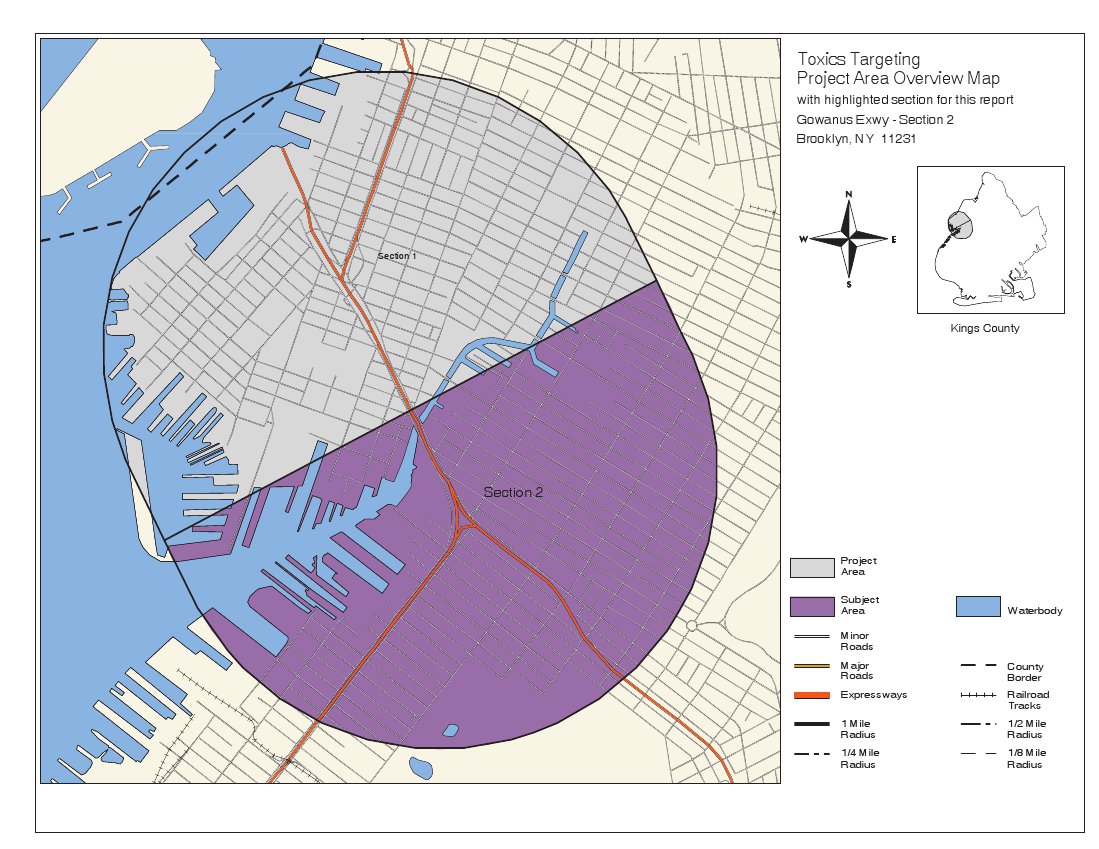
Section 2 Overview
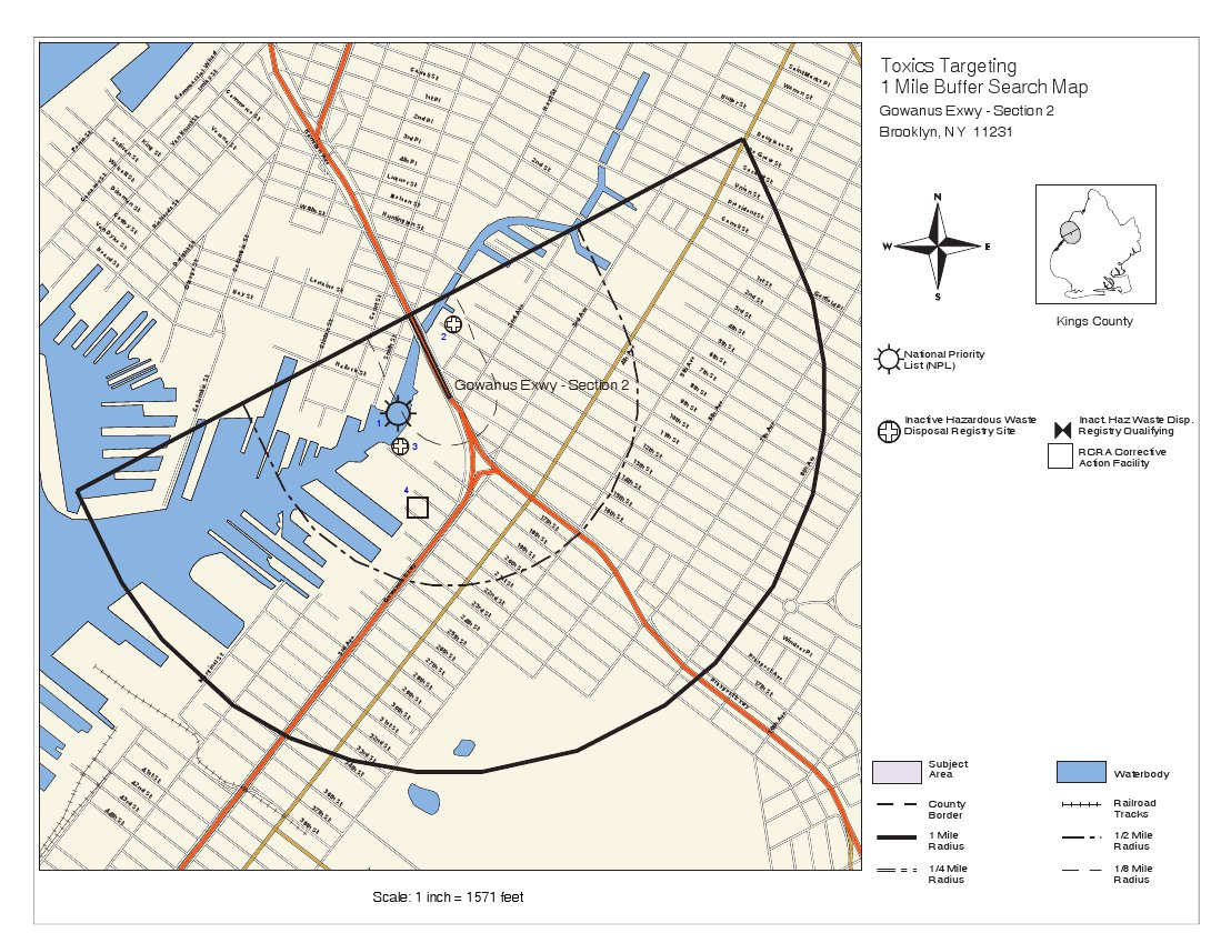
Section 2 1-mile Buffer
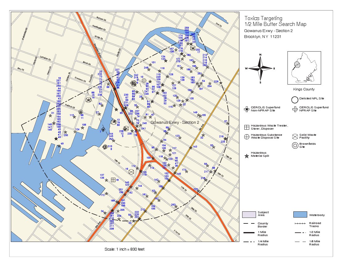
Section 2 1/2-mile Buffer
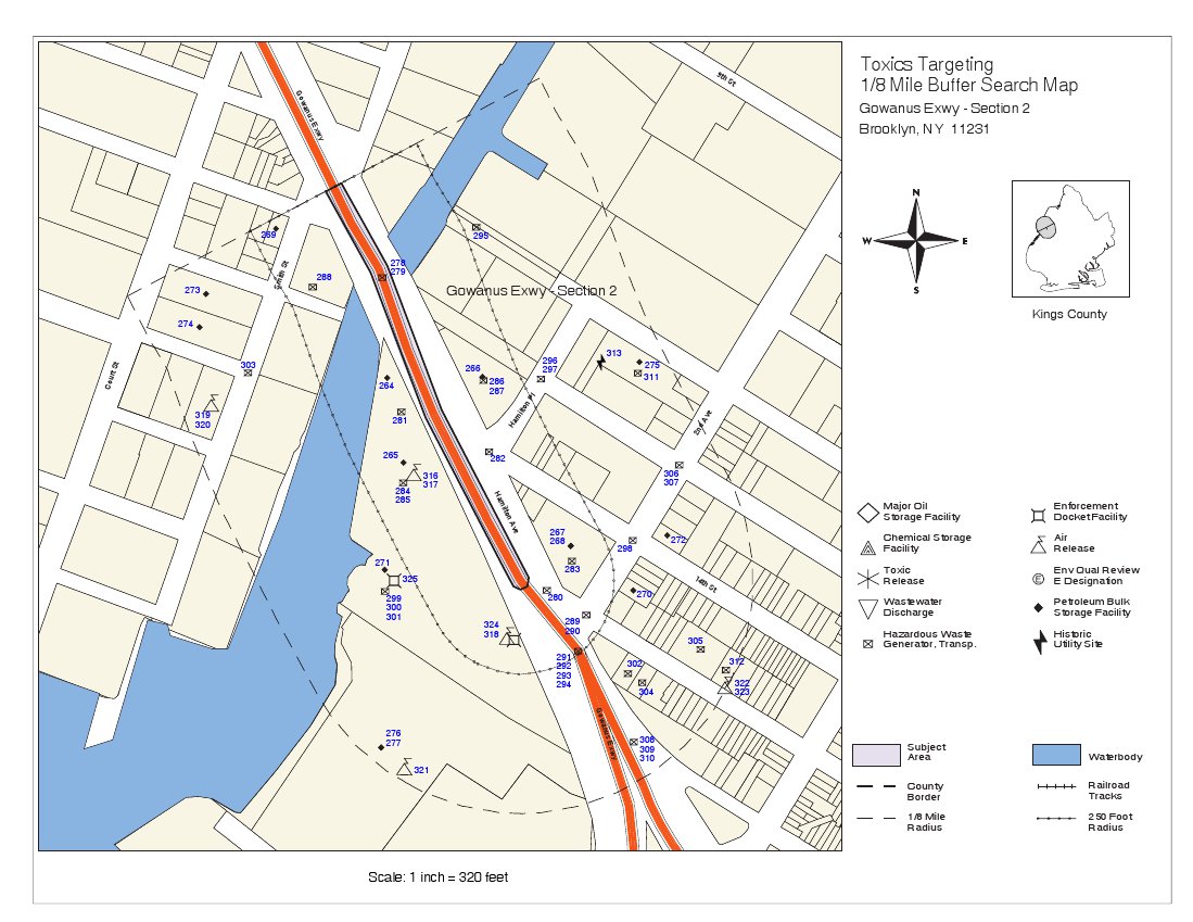
Section 2 1/8-mile Buffer
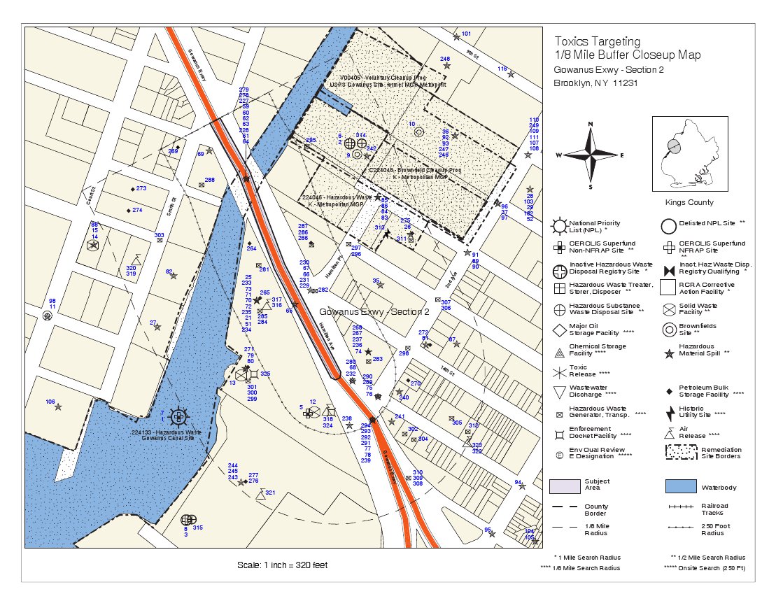
Section 2 1/8-mile Buffer Close-Up
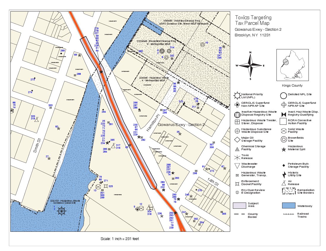
Section 2 Tax Parcel Map
Picture #1
Picture #2
Picture #3
Picture #4

Picture #5